The Plains Heartland — Roads & Eight Subregions
FLYGAME WORLD ATLAS / PLAINS HEARTLAND · Regional grammar inspected November 15, 2026 · Light geography spoilers
A world should have reasons to travel
The Plains Heartland is not described as an undifferentiated field of repeated grass tiles. Its current authored plains_region_grammar.json defines an 8×8 regional arrangement: eight distinct subregion symbols with their own landscape identity, landmarks and anticipated activities. This is authored region grammar; it is not proof that every described road and landmark appears in a current-ROM uninterrupted journey.
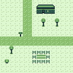
Eight subregions with distinct character
| Region | What the authored grammar describes |
|---|---|
| Rolling Grasslands (G) | Wind-shaped border terrain, scattered trees and broad lines of travel toward neighboring countries. |
| Temple Road Country (T) | Old pilgrim road, wayshrine markers, ruins and a gradual introduction to the Great Temple journey. |
| Stonefield Country (S) | Exposed rock, old field walls, standing stones and mineral-search or defensive encounter pockets. |
| Old Battlefield (B) | Flower-grown earthworks, broken carts, abandoned camps and a landscape carrying older conflict. |
| River Meadows (R) | Winding water, shallow fords, bridges, reeds, grazing meadows and fishing. |
| Village Outskirts (O) | Houses, gardens, workshop yards, fences and shorter lanes joining the central settlement. |
| Crossroads Heartland (V) | Waypost village, a well, market, services and signposts where the authored regional roads converge. |
| Farm Country (F) | Crop rows, fences, barns, orchards, hay and practical harvest paths. |
The three authored road corridors
The grammar also specifies named route cell reservations, not just vague suggestions for where a road might be. They form the basis of a geography with memorable connections.
- West Trade Road: enters from the western border grassland, reaches the river meadows and fording country, and passes the outskirts into the crossroads.
- Temple River Loop: brings the pilgrim road through temple-road country, follows the river, and moves into village approaches.
- Harbor Ferry Road: approaches from the eastern side, skirts old battlefield and farm-gate terrain, and connects toward Waypost's market crossroads.
Regional structure, not a finished navigation map
The 8×8 layout is a high-level authoring grammar. Its coordinates are not safe to present as a final player compass or exact dungeon walkthrough. The region's visual routes, edge families and guaranteed connectivity are subjects of ongoing worldbuilding work. The separate November 15 Living World / Roads & Places plan is explicitly a proposed roadmap emphasizing destination guarantees and road-tile variation; it is not evidence of a new completed runtime solver.
The Heartland's role in the adventure
Waypost gives the player a believable settlement between river, farms, ancient road and the wider world. Named landmarks are meant to make the world feel navigable without relying on endless identical wilderness. Later stages can deepen NPC activities, weather responses and alternate travel paths as gameplay and resource budgets permit.
Sources: content/World/plains_region_grammar.json (eight regions, three routes); docs/PLAINS_HEARTLAND_REGIONAL_BRIEF.md (dated design/audit); docs/FG_LIVING_WORLD_ROADS_PLACES_PLAN_20261115.md (proposal only).
Visit Waypost · Meet Its People · Great Temple · Full World Guide